Web-based geospatial multiple criteria decision analysis using open software and standards(IJGIS)
multiple criteria decision analysis (MCDA)
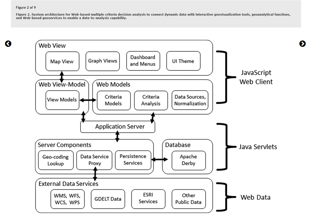
Web-based platform-->>open-source geotechnologies
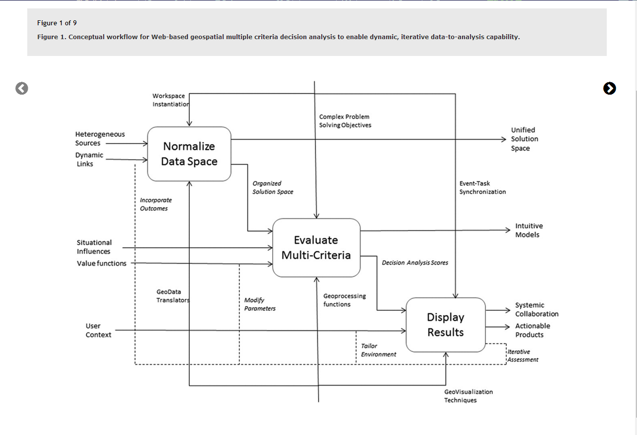
workflow:user can ingest and modify heterogeneous data formats, exploit temporally tagged data sources, create multicriteria decision analysis models, and visualize the results in an iterative and collaborative workspace.
open-source data to open-source analysis
Web Feature Service (WFS):
the exchange of raw geographic vector data
Web Map Service (WMS):
the exchange of preassembled (static) map imagery
Web Coverage Service (WCS):
underlying data so that they can be used for either data analysis and modeling
structure decision problems which integrate quantitative data with decision makers’ preferences for criteria trade-offs in order to prioritize alternatives
ingest real-time data feeds in a seamless manner to enable dynamic geoprocessing capabilities.
workflow and prototype :
Interoperability.
Data management.
Data discovery .
Data modification and geoprocessing.
Customizable decision models.
Agile software.
Collaboration.