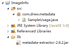
项目结构
第一步:添加需要的架包metadate-extractor.jar
架包下载地址:https://code.google.com/p/metadata-extractor/downloads/list
或者去Maven仓库下载 http://search.maven.org/#search%7Cga%7C1%7Cmetadata-extractor
第二步:编写解析代码
 1 package com.drew.metadata;
 2 import java.io.File;
 3
 4 import com.drew.imaging.ImageMetadataReader;
 5 import com.drew.imaging.ImageProcessingException;
 6 /**
 7  * java读取照片信息
 8  */
 9 public class SampleUsage{
10     public static void main(String[] args) throws Exception, Exception{
11         File file = new File("E:\带有地理位置的图片.jpg");
12         printImageTags(file);
13     }
14     /**
15      * 读取照片里面的信息
16      */
17     private static void printImageTags(File file) throws ImageProcessingException, Exception{
18         Metadata metadata = ImageMetadataReader.readMetadata(file);
19         for (Directory directory : metadata.getDirectories()) {
20             for (Tag tag : directory.getTags()) {
21                 String tagName = tag.getTagName();  //标签名
22                 String desc = tag.getDescription(); //标签信息
23                 if (tagName.equals("Image Height")) {
24                     System.out.println("图片高度: "+desc);
25                 } else if (tagName.equals("Image Width")) {
26                     System.out.println("图片宽度: "+desc);
27                 } else if (tagName.equals("Date/Time Original")) {
28                     System.out.println("拍摄时间: "+desc);
29                 }else if (tagName.equals("GPS Latitude")) {
30                     System.err.println("纬度 : "+desc);
31 //                    System.err.println("纬度(度分秒格式) : "+pointToLatlong(desc));
32                 } else if (tagName.equals("GPS Longitude")) {
33                     System.err.println("经度: "+desc);
34 //                    System.err.println("经度(度分秒格式): "+pointToLatlong(desc));
35                 }
36             }
37         }
38     }
39     /**
40      * 经纬度格式  转换为  度分秒格式 ,如果需要的话可以调用该方法进行转换
41      * @param point 坐标点
42      * @return
43      */
44     public static String pointToLatlong (String point ) {
45         Double du = Double.parseDouble(point.substring(0, point.indexOf("°")).trim());
46         Double fen = Double.parseDouble(point.substring(point.indexOf("°")+1, point.indexOf("'")).trim());
47         Double miao = Double.parseDouble(point.substring(point.indexOf("'")+1, point.indexOf(""")).trim());
48         Double duStr = du + fen / 60 + miao / 60 / 60 ;
49         return duStr.toString();
50     }
51 }
52