zoukankan      html  css  js  c++  java
  • ddd

    method1: BaoXing

    ref: Curb-Intersection Feature Based Monte Carlo Localization on Urban Roads

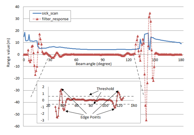
    • segmentation of laser scan

    image.png | center | 647x450

    1. piecewise function of laserscan

    image.png | center | 544x172

    1. use second-order differential filter to get local minimum-maximum detection point
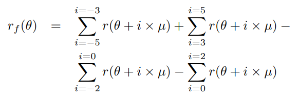
    image.png | center | 582x200

    we can think this as, after discussion woth Peng, we believe it's one-order differential function(the same in the picture, red curve):

    * classification of the scan 1. Road surface segment, shown as line CD, is selected first. It always locates between two edgepoints nearest to center of the sensor. 2. Curb lines, (BC and DE), are searchedsubsequently, based on point C and D determined fromthe former step. 3. Rest segments are other features off the road. * monte-carlo localization with these features 1. prediction with odom(easy part) 2. correction with two kind of features * curb point * intersection point

    image.png | center | 626x324

    1. resampling
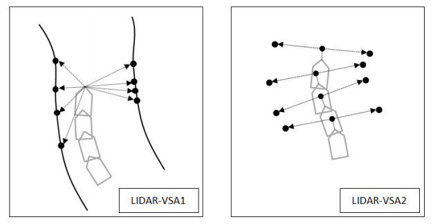
    • curb-intersection measurement model
    1. LIDAR-VSA1
      accumulate these curb point, and translate them to last coordinate
    2. LIDAR-VSA2
      it's just two parallel point, tagent to CD.And whenever at intersection, we get two these points

    method2

  • 相关阅读:
    小程序排错(redis导致)
    linux系统删除-开头文件或目录
    nginx 反向代理
    memcache
    一次故障过程
    json.Decoder vs json.Unmarshal
    ssl中间证书
    作业10:String类
    Angular6如何引入jQuery-knob
    OpenJdk源码下载
  • 原文地址:https://www.cnblogs.com/jsrgfjz/p/9969687.html
Copyright © 2011-2022 走看看