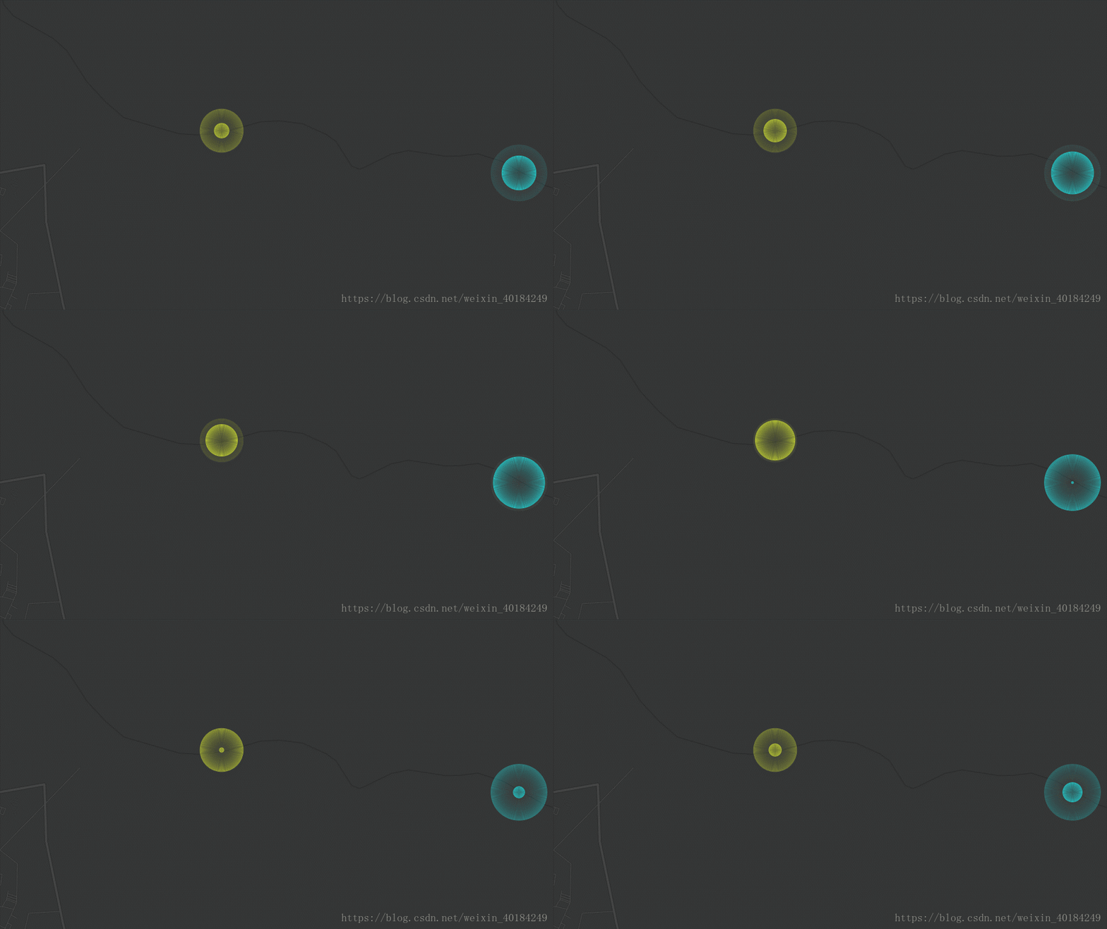
在博客中分享的关于Openlayer实现点动态扩散,今天分享一下关于ArcGIS API实现点动态扩散的效果,主要还用canvas写,这中间用一个rasterLayer的扩展图层。
先来看看效果:
一、完整demo代码:
<!DOCTYPE html>
<html>

<head>
    <title>arcgis map flashmarker</title>
    <meta http-equiv="Content-Type" content="text/html; charset=utf-8" />
    <meta name="viewport" content="width=device-width, initial-scale=1.0, maximum-scale=1.0, minimum-scale=1.0, user-scalable=no">
    <link rel="stylesheet" href="https://js.arcgis.com/3.25/esri/css/esri.css">
    <style>
        html,
        body {
             100%;
            height: 100%;
            margin: 0;
            padding: 0px 0 0 0;
        }

        #mapCanvas {
            padding: 0;
            height: 100%;
        }
    </style>
    <script type="text/javascript">
        dojoConfig = {
            parseOnLoad: true,
            packages: [{
                name: 'extend',
                location: this.location.pathname.replace(//[^/]+$/, "") + "/plugins"
            }]
        };
    </script>
    <script src="https://js.arcgis.com/3.25/"></script>
</head>

<body>
    <div id="mapCanvas">
    </div>
    <script>
        var map, rasterLayer, moveRiver, timer, animationId;
        require(["esri/map", "esri/request", "dojo/parser", "dojo/number", "dojo/json", "esri/geometry/Point",
            "extend/RasterLayer", "dojo/domReady!"
        ], function (Map, esriRequest, parser, number, JSON, Point, RasterLayer) {
            parser.parse();
            map = new Map("mapCanvas", {
                center: [112.91992, 30.450489],
                zoom: 11,
                basemap: "dark-gray-vector",
            });

            map.on("load", mapLoaded);

            var lnglats = [], //经纬度点的集合
                canvas = null, //定义canvas元素
                context = null, //上下文,canvas的api都是从这个变量中去调用;
                colors = ["#c1232b", "#27727b", "#fcce10", "#e87c25", "#b5c334", "#fe8463", "#9bca63",
                    "#fad860", "#f3a43b", "#60c0dd", "#d7504b", "#c6e579", "#f4e001", "#f0805a", "#26c0c0"
                ];

            function mapLoaded() {
                //定义一个canvas图层,叠加在地图上,用于绘制一些点、线基本图形
                baseLayer = new RasterLayer(null, {
                    opacity: 1
                });
                map.addLayers([baseLayer]);
                canvas = baseLayer._element; //canvas元素赋值
                context = canvas.getContext('2d'); //上下文赋值,canvas的api都是从这个变量中去调用

                //这里触发地图的移动、放大、缩小事件时,将调用redraw方法,对canvas上的圆点进行重新绘制
                map.on("extent-change", redraw);
                map.on("resize", function () {});
                map.on("zoom-start", redraw);
                map.on("pan-start", redraw);

                //加载河流经纬度点
                var layersRequest = esriRequest({
                    url: 'data/river-point.json',
                    content: {},
                    handleAs: "json"
                });
                layersRequest.then(
                    function (response) {
                        for (var i = 0; i < response.features.length; i++) {
                            if (i % 50 == 0) {
                                var feature = response.features[i];
                                var attribute = feature.attributes;
                                if (attribute.jmax == 3) {
                                    lnglats.push(new Point({
                                        "x": attribute.X_1_WGS198,
                                        "y": attribute.Y_1_WGS198,
                                        "spatialReference": {
                                            "wkid": 4326
                                        }
                                    }));
                                }
                            }
                        }
                        redraw(); //调用重新绘制的方法
                    }
                );
            };

            //设置屏幕的缩放比例,防止文字太小
            function resolutionScale(context) {
                var devicePixelRatio = window.devicePixelRatio || 1;
                context.canvas.width = context.canvas.width * devicePixelRatio;
                context.canvas.height = context.canvas.height * devicePixelRatio;
                context.canvas.style.width = context.canvas.width / devicePixelRatio + 'px';
                context.canvas.style.height = context.canvas.height / devicePixelRatio + 'px';
                context.scale(devicePixelRatio, devicePixelRatio);
            };

            function redraw() {
                //每次重新绘制时先清除正在运行的动画
                clearAnimation();

                //将canvas图层的宽、高设置为地图的高、宽,防止地图经纬度点转canvas坐标时定位不准
                canvas.width = map.width;
                canvas.height = map.height;

                //渲染环境在硬件设备上的缩放程度,防止图像、文字太小
                resolutionScale(context);

                //canvas只认识x,y坐标,对于arcgis、baidu、google各类地图的经纬度坐标识别不了
                //因此这里需要将经纬度点转换成屏幕坐标x,y,也就是canvas坐标,才能在canvas上去绘制各种图形
                //每种地图转换坐标的方法不同,但大同小异,这里使用的是arcgis地图,因此用的转换方法为map.toScreen(Point)
                //定义一个类型为数组的points变量,用来存储转换为canvas坐标的点集合
                var points = [];
                lnglats.forEach(function (p) { //循环每一个经纬度点
                    var _point = map.toScreen(p); //将经纬度点转为canvas坐标点
                    points.push({
                        pixel: _point,
                        size: 0,
                        speed: 0.5 + Math.random(),
                        max: Math.floor(Math.random() * 80),
                        color: colors[Math.floor(Math.random() * colors.length)]
                    }); //将转换后的canvas坐标点添加到points数组中
                });

                /*======================点动画效果开始======================*/
                function animate() {
                    //点运动尾巴效果关键代码
                    //每绘制一次动画,canvas图层的透明度变成0.9,第2次透明度为0.9*0.9,第3次透明度为0.9*0.9*0.9...,以此类推
                    //这样重复绘制改变透明度后,已绘制的圆点将越来越透明
                    context.fillStyle = "rgba(0,0,0,0.95)";
                    var prev = context.globalCompositeOperation;
                    context.globalCompositeOperation = "destination-in";
                    context.fillRect(0, 0, self.map.width, self.map.height);
                    context.globalCompositeOperation = prev;

                    points.forEach(function (p) {
                        context.beginPath();
                        context.arc(p.pixel.x, p.pixel.y, p.size, 0, Math.PI * 2); //圆点x、y坐标,颜色等
                        context.strokeStyle = p.color; //圆点颜色
                        context.stroke();

                        //圆绘制到最大时,从头开始
                        p.size += p.speed;
                        if (p.size > p.max) {
                            p.size = 0;
                        }
                    });
                }

                (function drawFrame() {
                    //用setTimeout是为了更好地控制动画的速度,每150毫秒绘制一次
                    timer = setTimeout(function () {
                        if (animationId) {
                            cancelAnimationFrame(animationId); //每次运行动画前,先清除之前的
                        }
                        animationId = requestAnimationFrame(drawFrame); //循环更新动画
                        animate();
                    }, 150);
                })();
                /*======================点动画效果结束======================*/
            }

            //清除动画
            function clearAnimation() {
                if (animationId) {
                    cancelAnimationFrame(animationId);
                }
                if (timer) {
                    clearTimeout(timer);
                }
            }
        })
    </script>
</body>

</html>
二、关于扩展图层rasterlayer
define([
    "dojo/_base/declare", "dojo/_base/connect", "dojo/_base/array",
    "dojo/dom-construct", "dojo/dom-style", "dojo/number",
    "esri/lang", "esri/domUtils",
    "esri/SpatialReference", "esri/geometry/Point", "esri/layers/layer"
  ], function(
    declare, connect, arrayUtils,
    domConstruct, domStyle, number,
    esriLang, domUtils,
    SpatialReference, Point, Layer
  ) {
    var RL = declare([Layer], {
      // Doc: http://docs.dojocampus.org/dojo/declare#chaining
      "-chains-": {
        constructor: "manual"
      },

      constructor: function(data, options) {
        // Manually call superclass constructor with required arguments
        this.inherited(arguments, [ "http://some.server.com/path", options ]);

        this.data = data;

        this.loaded = true;
        this.onLoad(this);
      },

      /********************
       * Public Properties
       *
       * data
       *
       ********************/

      /**********************
       * Internal Properties
       *
       * _map
       * _element
       * _context
       * _mapWidth
       * _mapHeight
       * _connects
       *
       **********************/

      /******************************
       * esri.layers.Layer Interface
       ******************************/

      _setMap: function(map, container) {
        this._map = map;

        var element = this._element = domConstruct.create("canvas", {
          id: "canvas",
           map.width + "px",
          height: map.height + "px",
          style: "position: absolute; left: 0px; top: 0px;"
        }, container);

        if (esriLang.isDefined(this.opacity)) {
          domStyle.set(element, "opacity", this.opacity);
        }

        this._context = element.getContext("2d");
        if (!this._context) {
          console.error("This browser does not support <canvas> elements.");
        }

        this._mapWidth = map.width;
        this._mapHeight = map.height;

        // Event connections
        this._connects = [];
        this._connects.push(connect.connect(map, "onPan", this, this._panHandler));
        this._connects.push(connect.connect(map, "onExtentChange", this, this._extentChangeHandler));
        this._connects.push(connect.connect(map, "onZoomStart", this, this.clear));
        this._connects.push(connect.connect(this, "onVisibilityChange", this, this._visibilityChangeHandler));

        return element;
      },

      _unsetMap: function(map, container) {
        arrayUtils.forEach(this._connects, connect.disconnect, this);
        if (this._element) {
          container.removeChild(this._element);
        }
        this._map = this._element = this._context = this.data = this._connects = null;
      },

      /*****************
       * Public Methods
       *****************/

      refresh: function() {
        if (!this._canDraw()) {
          return;
        }
      },

      clear: function() {
        if (!this._canDraw()) {
          return;
        }

        this._context.clearRect(0, 0, this._mapWidth, this._mapHeight);
      },

      /*******************
       * Internal Methods
       *******************/

      _canDraw: function() {
        return (this._map && this._element && this._context) ? true : false;
      },

      _panHandler: function(extent, delta) {
        domStyle.set(this._element, { left: delta.x + "px", top: delta.y + "px" });
      },

      _extentChangeHandler: function(extent, delta, levelChange, lod) {
        if (!levelChange) {
          domStyle.set(this._element, { left: "0px", top: "0px" });
          this.clear();
        }
      },

      /****************
       * Miscellaneous
       ****************/

      _visibilityChangeHandler: function(visible) {
        if (visible) {
          domUtils.show(this._element);
        }
        else {
          domUtils.hide(this._element);
        }
      }

    });

    return RL;
  });