Principles of GIS( UNSW Metternicht )
outline:data input---data management---data manipulation+data analysis---spatial modelling
Definition
1. GIS is a tool to digitally abstract the real world, information is connected to its physical location and organized into layers.
2. a GIS consists at least information database( with attribute ), map information, computer-based link between them.
GIS storement
1. people manage database information by layer or theme
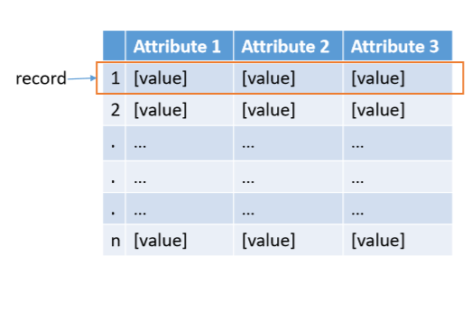
2. a value can be a number or a text
type of data( vector矢量 raster栅格)
1. spatial data (空间数据): has location information, giving the information about where is it, can be mapped, spatial data models begin with conceptualization, how you will represent the real world phenomena or entities( road, river, etc.), which is the objects in a spatial database plus the relationships among them.
2. attribute data: giving the information about what is it.
3. topology(拓扑): what related to this feature
attribute data
non-spatial GIS data related to a spatial location. For example, attribute data may be a soil type or a landholder's name
1. nominal attributes: provide descriptive information about an object (for example, colors、city names or vegetation type), which can also be images, audios or other kinds of descriptive information.
2. ordinal attributes: imply rank order or scale by their values ( for example, small、medium、large, ranking from 1 to 10 ).
3. interval or ratio attributes: are used for numeric items where both order and difference in magnitudes( 量级 ) are reflected in number( real number in a linear scale, for example: height、weight, etc.)
data model concept
in GIS data modeling refers to the way in which data can be used to predict or explain a spatially based process. The data structure refers to the manner in which GIS allows storage and display of spatial information. the most common structrues are vector and raster.
1. vector data model: discrete objects (point,lines)
2. raster data model: continuous phenomena (use grid cells)
vector data model
1. point: to represent the location
2. line: to represent linear features
3. polygon: represents entities which covers an area
raster data model (cells)
rasters are digital aerial photographs, imagery from satellites, digital pictures, or even scanned maps
TIN data model---tesselations (Triangulated Irregular Network)
1. TIN is a data model commonly used to represent terrain (地势) heights, which will be describes as x,y, and z locations.
2. TIN used for digital elevation models (DEM) or digital terrain models (DTM).
vector data
1. can be multipart
2. polygons can have holes
3. holes can contain islands
4. can overlap
vector model
the direction of a line is determined by the order of its vertices (制高点)
polygon exteriors (外观) are stored in an anticlockwise(逆时针) order
顺时针方向为内孔方向(Internal holes)
total area of the polygon areas is the sum of the part areas
raster data
a cell’s coordinate is inferred from its file order, the cell size and corner coordinates (坐标)
nodata means the value is not known or is not relevant